CHARTS BY REGION
BAHAMAS
CALIFORNIA & MEXICO
CARIBBEAN ISLANDS
CAROLINAS & GEORGIA
FLORIDA
GREAT LAKES
GULF COAST
More
CHARTS BY STYLE
COASTAL FISHING
INSHORE FISHING
LAKE FISHING CHARTS
LARGE PRINT CHARTS
OFFSHORE FISHING
STANDARD NAVIGATION
More
CHARTS BY REGION
BAHAMAS
CALIFORNIA & MEXICO
CARIBBEAN ISLANDS
CAROLINAS & GEORGIA
FLORIDA
GULF COAST
More
CHARTS BY STYLE
COASTAL FISHING
INSHORE FISHING
LAKE FISHING CHARTS
LARGE PRINT CHARTS
OFFSHORE FISHING
STANDARD NAVIGATION
More
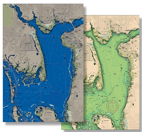

HOVER OVER YOUR REGION TO FIND A CHART NEAR YOU


FRAMED CUSTOM CHARTS
FRAMED CUSTOM CHARTS


CUSTOM CHARTS
PERSONALIZE YOUR EXPERIENCE
By popular demand! Professional, custom framing at affordable prices! Ready to hang! The price includes the frame, the chart, labor, and FREE SHIPPING directly to the continental US. Call us for shipping prices to other locations! Frames are solid wood (view frame choices) with your choice of double matte colors (2 ½ inch).
Please be sure to specify which side of the chart is to be framed, as our charts are two sided. When you view any chart on our website, Side A is first. Do not hesitate to contact us if you are unsure about your side choice.
CUSTOMIZE
