

Description
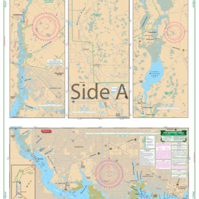
Enlarged and color enhanced to make it much easier to read, this chart covers the area from Portland Head east to Cape Small and north to the New Meadows River bridge. Offering complete detail of the Royal and Harraseeket Rivers, this chart will be useful for local yachtsmen as well as cruisers. Over 30 waypoints for important markers and positions are plotted which makes it easy to set up your GPS. Information from NOAA chart #13290. You can’t be without these marine charts if you live in the Casco Bay Maine area. This navigation chart can also be custom framed and makes the perfect gift for those who love the water. This nautical chart is enlarged and color enhanced to make it easy to read while on the water. This navigation map covers the area from Portland Head east to Cape Small and north to the New Meadows River bridge. There is also very detailed coverage of both the Royal and Harraseeket Rivers. There are over 30 GPS waypoints indicating important markers, and locations. Information from NOAA chart #13290. Nautical Chart is 25″ X 38″. WGS84 – World Mercator Datum.


Reviews
There are no reviews yet.